
Technical user manual
Step-by-step instructions for registration, advisory generation, rapid analysis, livestock feed advisory, and data downloads.
1. Introduction
AgWise is an agricultural advisory platform providing location-specific recommendations for:
- Yield predictions — expected crop yields under different rainfall scenarios
- Fertilizer recommendations — inorganic fertilizer application rates
- ISFM — integrated soil fertility management (organic inputs)
- Forage suitability — suitable forage varieties
- Livestock feed advisory — feed balance and forage recommendations
Supported countries: Ethiopia, Rwanda, Kenya, Ghana
2. Getting Started
System requirements:
- Modern web browser (Chrome, Firefox, Safari, Edge)
- Internet connection and JavaScript enabled
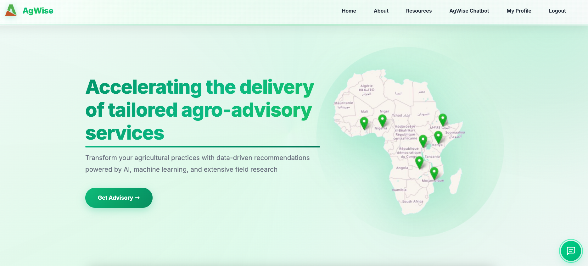
Navigate to dashboard.agwise.org or your local instance at localhost:3000.
3. Registration and Login
Create an account:
- Click Sign in in the navigation menu
- Choose Register / create account
- Fill in first name, last name, username, email, password, organisation, and country
- Click Register — you will be logged in automatically
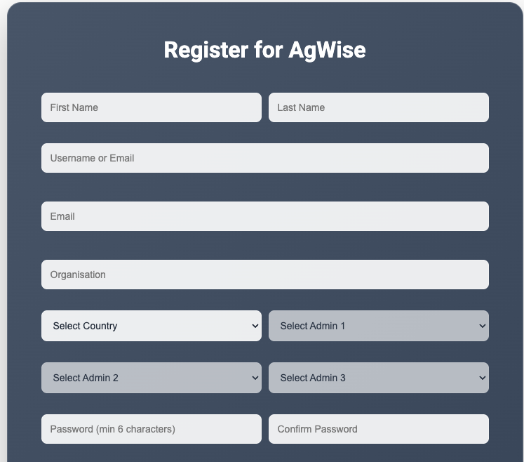
Login: Enter username and password. Sessions remain active for 24 hours.
5. Generating Advisories
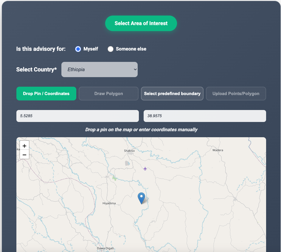
Step 1 — Select location
- Administrative boundary (country → region → zone → district)
- Draw polygon on the interactive map
- Upload shapefile (.zip)
- Enter point coordinates (lat/lng)
Step 2 — Select advisory type
- Crop advisory — yield, fertilizer, ISFM (crop varies by country)
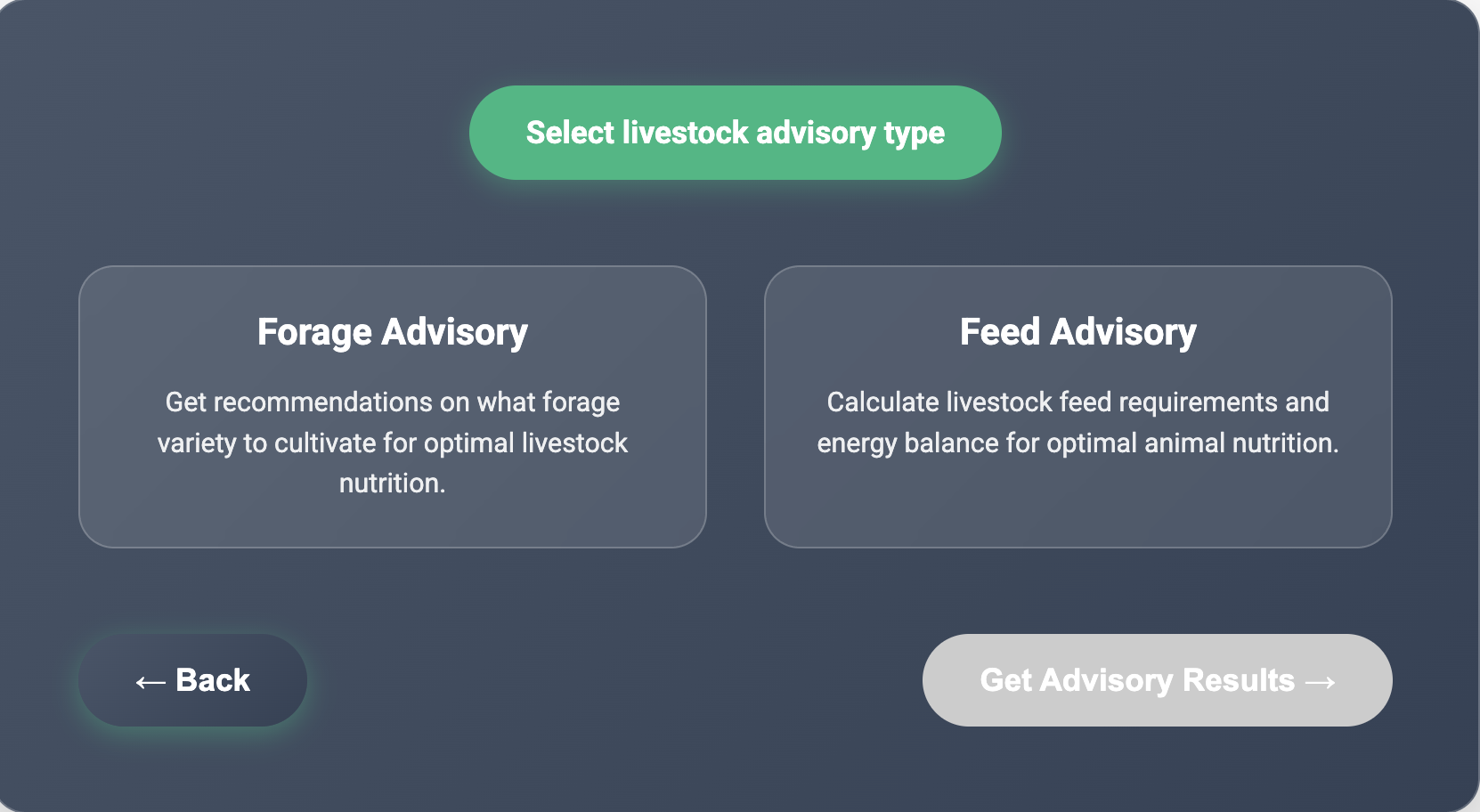
- Livestock advisory — forage suitability or feed balance (see Section 7)
Step 3 — View results
Results appear as tables, charts, and interactive Leaflet maps with raster overlays. Click the map to extract pixel values.
Step 4 — Download
Export as CSV (data only) or ZIP (data + GeoTIFF maps).
6. Rapid Analysis
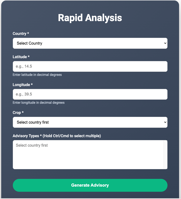
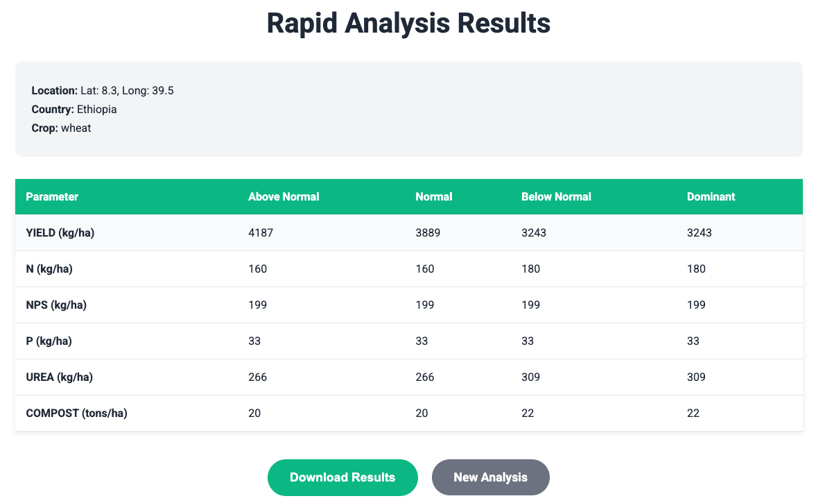
For quick single-point advisories without the full wizard:
- Open location selection and choose rapid analysis
- Fill in coordinates, crop, and advisory type
- Generate and view results in a formatted table
- Download CSV results
7. Livestock Feed Advisory
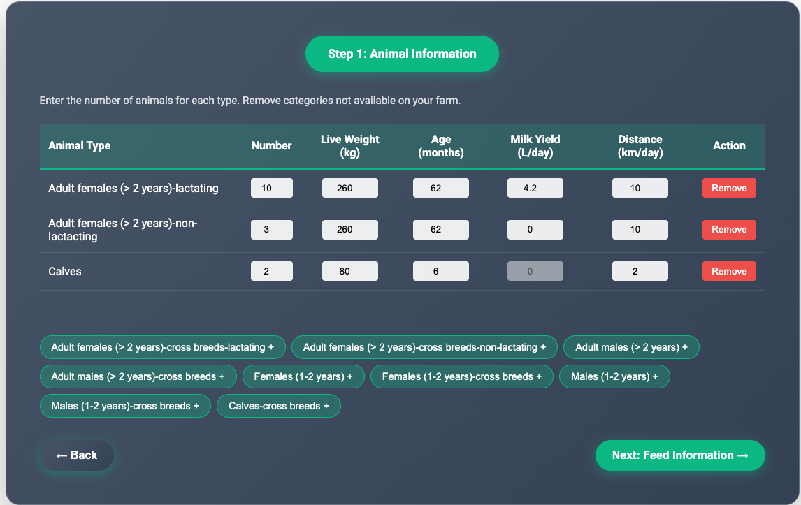
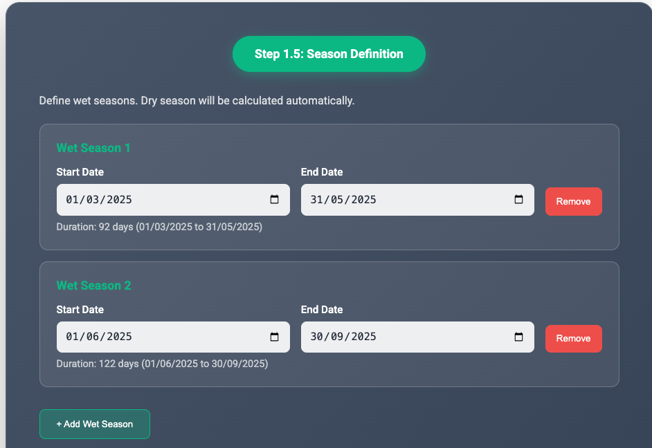
The feed advisory workflow includes:
- Define herd data (animal types and numbers)
- Configure seasons and production periods
- Enter crop production and feed sources
- Review inputs and calculate seasonal dry-matter balance
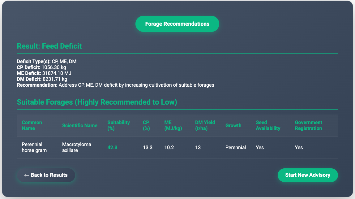
- View forage recommendations based on deficits
9. Downloading Data
CSV exports contain tabular advisory values per scenario.
ZIP exports include CSV data plus GeoTIFF raster maps and metadata for GIS use.
11. Troubleshooting
- Invalid coordinates — ensure lat/lng fall within the selected country boundary
- Crop not available — check supported crops for your country in the API docs
- Session expired — log in again (sessions last 24h)
- Map not loading — disable ad blockers; check internet connection
- Download fails — ensure advisory completed successfully first
Support: agwise@cgiar.org
Version 1.0 · Last updated March 2025 · AgWise Development Team